
The origin of many human settlements can be traced back to where streams of water have allowed people to flourish. We dip into the stories behind the rivers that made our cities and towns
Placed end to end, South Africa’s rivers would encircle the earth four times. That’s a total length of roughly 163 533 km. Little wonder they play such an important part in the naming traditions that define the places we’ve chosen to put down roots.
Baakens River Valley
The Baakens River Valley in the Eastern Cape is a green lung that lets the Nelson Mandela Bay metro breathe. The 2021 Xhosa tongue-twister name change of Port Elizabeth to Gqeberha had some people getting their clicks all wrong. Gqeberha is the isiXhosa name for the Baakens River and the Walmer township in the seaside city. The change brought to bring dignity to the black communities living there. Perched on the banks of the scenic Baakens River in the centre of Gqeberha, you’ll find the Settlers Park Nature Reserve, flanked by residential neighbourhoods but secluded by the sheer abundance of its lush vegetation. Bird-watchers will enjoy the two-kilometre walk through Settlers Park, where more than 100 bird species can be spotted. Our favourites are the peregrine falcon, Knysna woodpecker and southern tchagra.

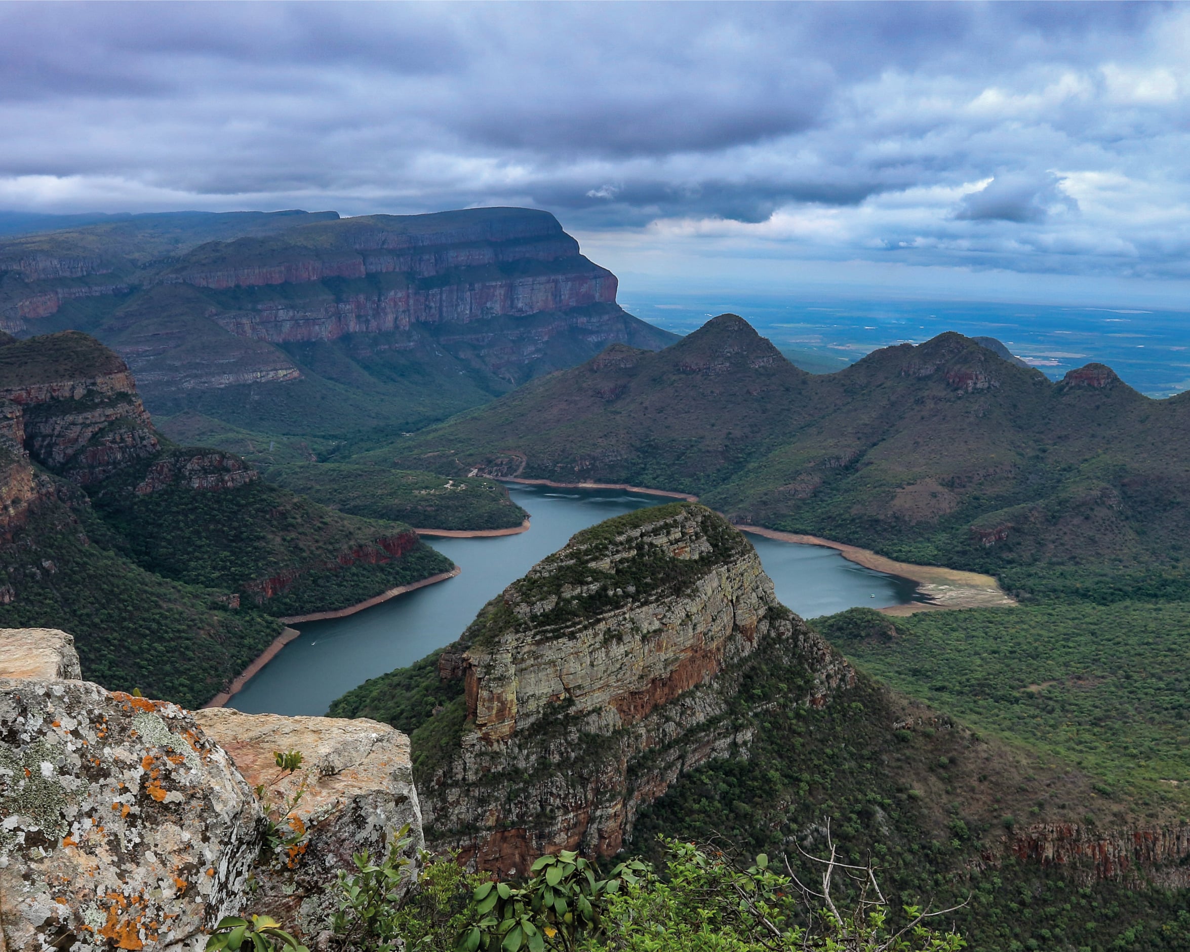
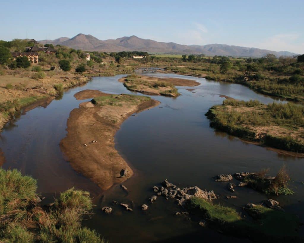
Crocodile River
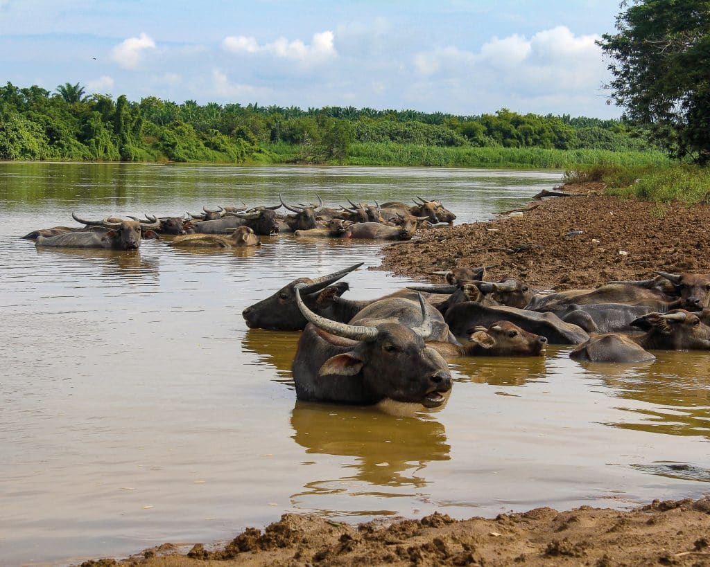
The Crocodile River in Mpumalanga is unsurprisingly named after the variety of native crocodiles that frequent it and is a significant tributary to the Komatiriver. Rising north of Dullstroom, it flows 306 km, mainly eastwards, to the confluence at Komatipoort. The river actually forms the southern boundary of the popular Kruger National Park. Head over to the Olifants River Gorge in the area, where researchers once found a very high density of 30 crocodiles per kilometre of shoreline. Also, pop into the Lowveld National Botanical Garden and visit the wildlife conservancy at Marloth Park.
Suburban and Town Rivers
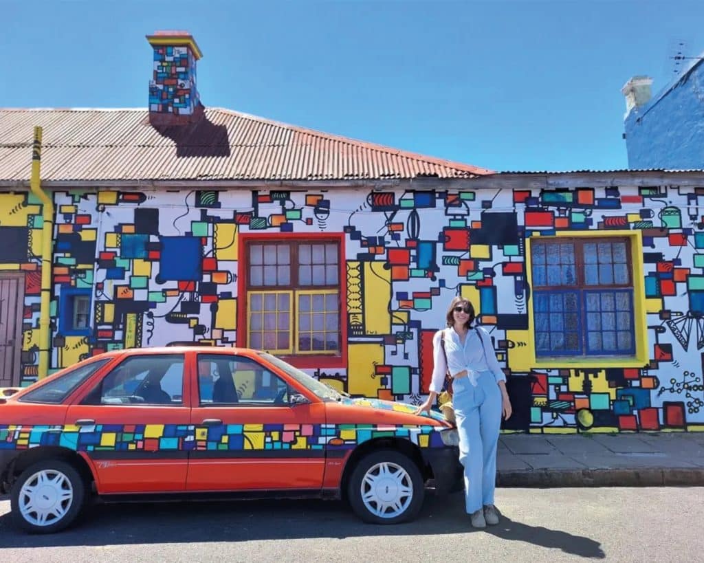
South Africans like naming towns and suburbs after the rivers we settle next to for survival and sustenance. Salt River is named after the river of the same name formed by the confluence of the Liesbeek and Black Rivers. Here, the street art will draw you in, and you will get plenty of opportunities to take pics for the ’gram. Head south, and you’ll find Diep River, named after the river that runs through the neighbourhood wedged in between Plumstead, Heathfield and The Vines. This is the perfect place to stop for some freshly baked goodies at Martin’s Bakery, a staple of the suburb since the ’70s.
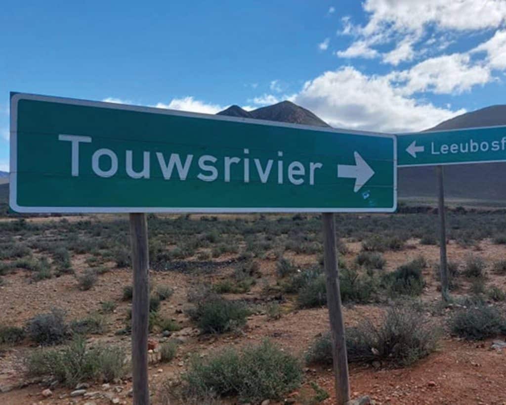
Touwsriver
Head towards Laingsburg, and you’ll pass through Touwsriver. The town was founded when a railway route over the Hex River Mountains connected the Cape with Kimberley’s newly discovered diamond fields. ‘Touws’ refers to the Khoi word for ash, in reference to the local ash bushes dotting the landscape, but it’s uncertain whether the name initially referred to the bushes, the soil’s colour, or the colour of the river. Here, the undulating landscape transitions from Kaapse Fynbos to Renosterveld, and if you look hard enough, you’ll spot the rare black dot chincherinchee, which blooms from August to September.
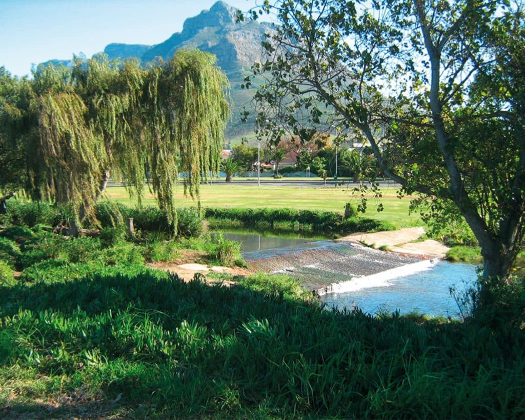
Liesbeek River
The Liesbeek River in Cape Town is less than 9 km long. It was the first river in Cape Town named by Jan van Riebeeck. ‘Beek’ is Dutch for stream, and ‘lies’ is a reed. The ‘old Cape Town’ grew around the Castle of Good Hope, built to protect the early settlement, and the Company’s Garden was initially laid out for fresh produce, farmed by the early settlers. But, a trading post as important as the Cape also needed liquid libation, so Van Riebeek built a brewery. The Liesbeeck became the primary water source for the operation, later acquired by South African Breweries (SAB) and is still up and running in Newlands. If you have a morning free, you can walk almost the entire length of the Liesbeek River on public footpaths, which will take youfrom the lovely Kirstenbosch through Fernwood, Newlands, Rosebank, Mowbray and Observatory.
Buffalo River
East London is South Africa’s only remaining river port situated at the mouth of the Buffalo River in the Eastern Cape. The Daimler plant located next to the harbour manufactures Mercedes Benz and other vehicles for the local market, exporting to the United States and Brazil. But that isn’t what makes East London special – the bucket-list items are the treasure trove of fossils at the Nahoon Point Nature Reserve and the climb up the 77 m Magoza dune at the Kwelera Botanical Gardens.
Zambezi River
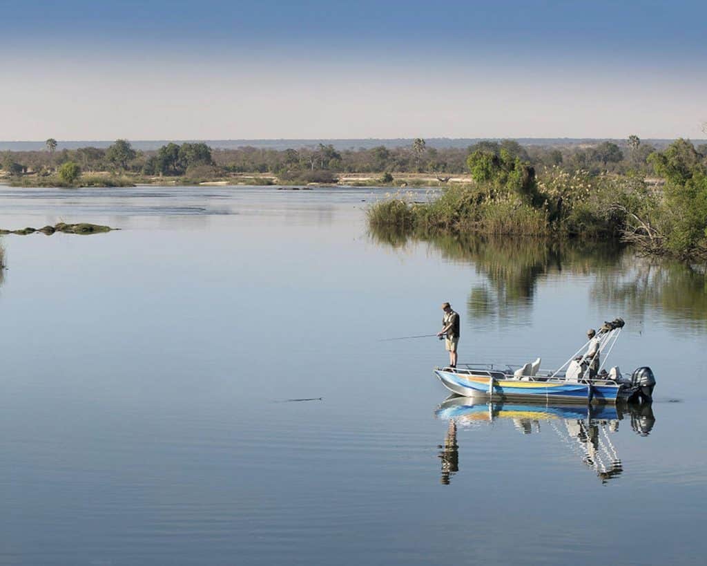
Elsewhere in southern Africa, there are cool rivers, too. The Zambezi River has its source in northwestern Zambia, flows through six countries and has only 13 bridges crossing its 2 700 km length. It is the fourth largest river on the African continent. It holds two hydroelectric plants (The Kariba Dam in Zimbabwe and the Cahora Bassa Dam in Mozambique) and is protected by a god. The Nyami Nyami, described as having the head of a fish and the body of a snake, is the guardian and god of the Zambezi River Valley. It is also one of the most important deities of the Tsonga people.You’ll also need to pray to the gods if you take on what is arguably the world’s best and most thrilling one-day white water rafting on the Zambezi. The 24 rapids just below the Victoria Falls wind their way through the Batoka Gorge, and the rapids range from Grade III to Grade V – the highest commercial grading possible. Battle your way through rapids such as The Devil’s Toilet Bowl, The Gnashing Jaws of Death, Morning Glory, Oblivion, and The Ugly Stepsisters to emerge wet, shaken and victorious.
Words by Mart-Marié du Toit
Photography: Rudolph Botha, Unsplash, Courtesy